I like finding the unseen history that surrounds us.
So recently, I finally did something I’ve been wanting to do for several years — I drove the last leg of the Mormon Pioneer Trail.
My family tree includes a few great-great-greats who came across the Mormon Trail. And my husband, well he’s 100% pure Mormon pioneer stock. That makes him sound like a cow. Or a horse…
He’s not. But that’s how people talk about pioneers. I think it’s funny. But I digress.
I wanted to see what my pioneer people experienced on the final part of the trail, which is only an hour (or so) from Salt Lake City. And I thought I’d have my kids — 7, 6, and 3 — come along. As a learning experience. And, maybe, something fun.
But I was wrong…
The Donner / Mormon / Pony Express Trail
The Mormon Pioneer Trail is a defining part of Utah history. It goes from Nauvoo, Illinois, to Salt Lake City. Some 70K people travelled it from 1847 until the train got to Utah in 1869.
That infamous Donner Party actually blazed much of the Mormon Trail’s Utah portion a year before the first Mormons came through. This was one thing that slowed the Donners down and led to their, um, unpleasantness in California’s snowy Sierra Nevadas.
Some California-bound settlers used Utah’s trail for a few years, but it wasn’t the best way to get to Cali.
The Pony Express Trail (1860-61) also follows the Mormon Pioneer Trail, at least from the Utah border to Salt Lake.
So, if your people participated in any of these, they may have travelled the Mormon Trail.
A great day trip from Salt Lake City
I found a 128-page auto-tour guide created by the National Park Service. 128 pages! Woah…
From this guide, I selected 10+ stops for our journey. Then I buckled the kids in to the minivan and headed toward the Utah border.
The truth: I wouldn’t stop at as many places if I went again.
Here’s a look at the 8 places I recommend stopping at and why. (The National Park Service guide, pages 49-75, includes lots more stops and detail if you’re interested.)
It’s a great day trip from Salt Lake City to do with kids.
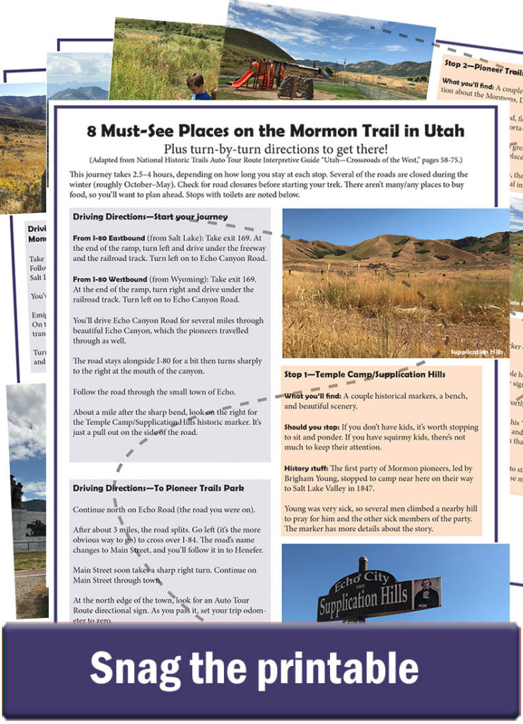
Want to do this too? I created a free printable with turn-by-turn directions. Just download and go!
We spent about 3 hours on the trail: 1.5 hours was driving. The remaining was stopping and exploring. This 3 hours doesn’t count the time getting to the “trail start” or the time travelling home from SLC. This was an all-day activity for our family.
Don’t stop here with kids
We started this road trip at the mouth of beautiful, red-cliffed Echo Canyon, which is where I-80 meets I-84, about 25 miles east of Park City. (In other words, we didn’t start exactly at the Utah/Wyoming border.)
There’s a side road that follows the Mormon Trail fairly closely, and we headed west on that road out of Echo Canyon toward the small town of Henefer.
Along the way is the Temple Camp and Supplication Hills.
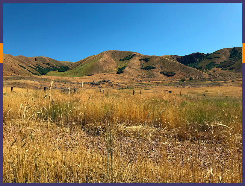
The first party of Mormon pioneers, led by Brigham Young, camped near here on their way to Salt Lake. Young was very sick, so several men climbed a nearby hill to pray for him and the other sick members of the party.
There isn’t much at this stop besides a historical marker and a bench. I recommend stopping here if you don’t have young kids with you. It didn’t have much to keep the attention of 3 antsy kids who had already been in the car for about 2 hours.
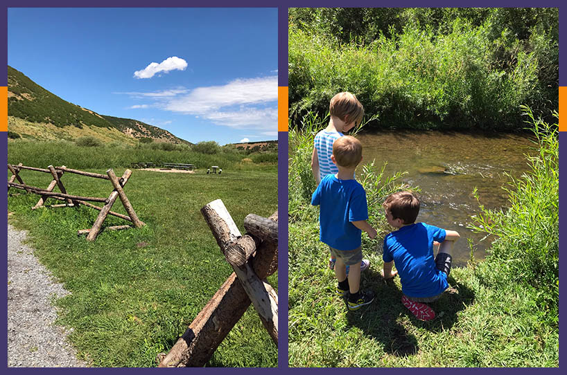
But check out this kiddo pitstop
The very small town of Henefer is home to Pioneer Trails Park.
By way of historical interest, there’s not much here. Just a couple signs with general information about the Mormons, Donners, and Pony Express.
However, by way of letting kids release energy, this is the place. (See what I did there?)
It’s got a playground, large field, covered picnic tables and BBQs, and even a fire pit. (Oh, and a porta-potty.) It’s a great place for a picnic and to let kids play.
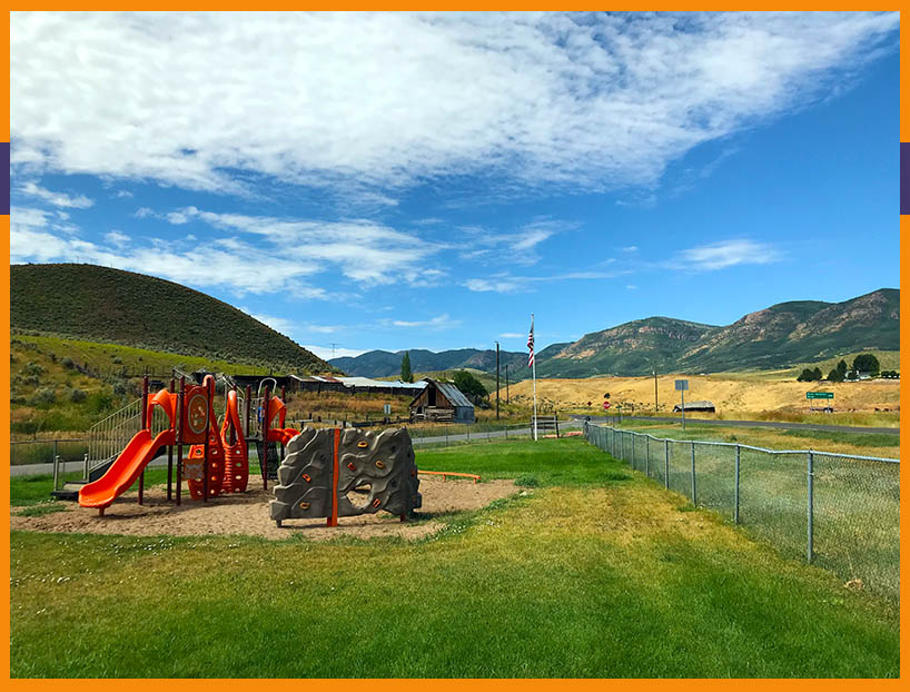
My recommendation: If you’ve got littles, stop and have a fun break/lunch. If you don’t have kids, you probably won’t get much from the historic signs.
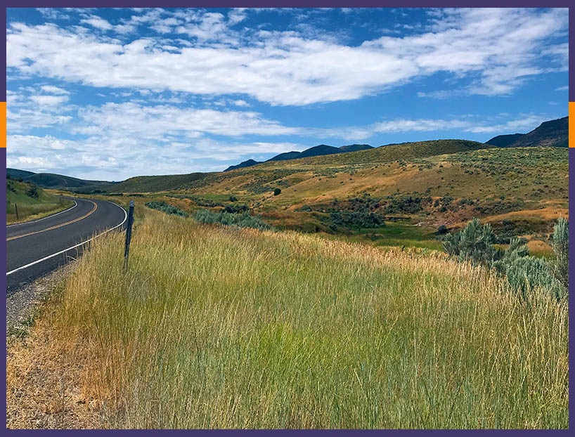
Driving up Main Canyon
Henefer is at the mouth of Main Canyon, which is visible from the Pioneer Trails Park. You’ll drive up Main Canyon, roughly along the path of the original trail.
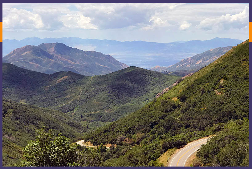
The most heartbreaking stop
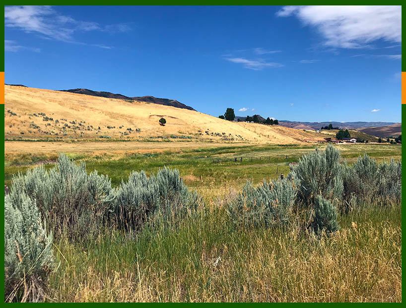
Hogsback Summit was one of my favorite stops — because of the view and what it meant.
Pictures don’t do it justice, but you come to the summit, and all you can see ahead of you is mountain after mountain after mountains.
People have come to call this “Heartbreak Ridge,” because after nearly 4 months and 1,200 miles on the trail, the pioneers would have seen that the hardest part of the journey was still ahead.
Standing on a boulder next to the historic marker, I tried to imagine what it would have been like to be a pioneer woman with three young children realizing we had to cross what I saw in front of us.
There are supposed to be wagon ruts here, but I couldn’t identify them…
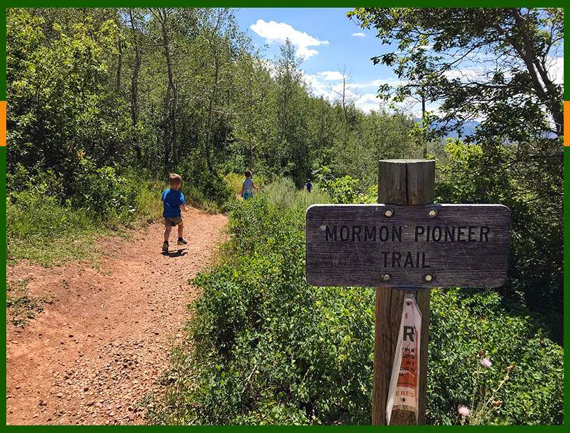
Walking the actual Mormon Trail
The road continues down from Hogsback Summit and into East Canyon, where it passes by East Canyon Reservoir. The original trail went through the bottom of the reservoir, which my kids thought was funny. I couldn’t seem to explain to them how man-made reservoirs work.
Several miles after the reservoir, the trail and the road separate for a bit. But taking a side, dirt road lets you stay along the trail.
A couple miles down this road is a turn out where you can walk along the original trail for about a quarter mile.
If you want to experience what it must have really been like to be a pioneer on the trail, I suggest walking it for a bit. It’s a very easy walk.
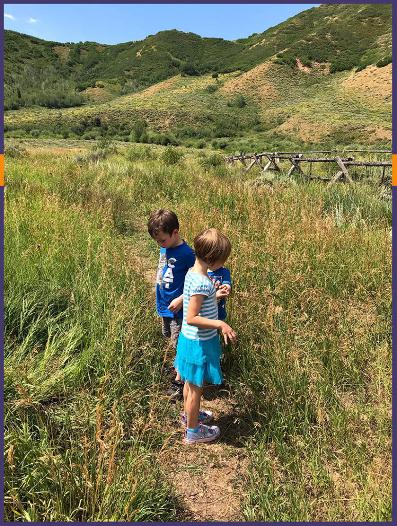
In early August, the grasses were long and the crickets were loud. My son told my daughter that the cricket chirping was rattlesnakes in the grass. That sent her screaming back to the minivan, where she continued to shriek until we got back there.
So I didn’t get to walk along as much of the trail as I would have liked…
Bushwhacking through Mormon Flat
Mormon Flat was my favorite stop.
It’s now a campground at the base of Big Mountain. It’s green and lush and just beautiful. A creek runs through the area.
From Mormon Flat, the Mormon Pioneer Trail heads up Big Mountain, which was the highest summit the pioneers had to climb. You can walk/bike the actual trail up to the summit of Big Mountain, but the road takes a different route to the summit.
The trail from Mormon Flat to Big Mountain Summit is supposedly well travelled, but we found it overgrown with grasses. I felt like I was bushwhacking my way through a jungle. The grasses were so high that I couldn’t see Big Mountain from where we were, even though it was right in front of us.
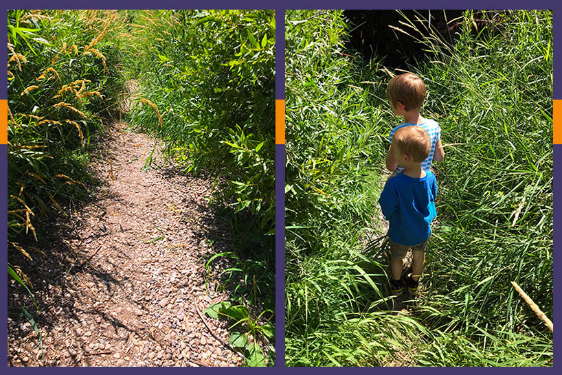
The first group of Latter-day Saint pioneers apparently had some trouble following the trail that the Donner Party blazed just the year before. Seeing these grasses, I had no doubt as to why.
Brigham Young’s pioneer party camped here on July 22, 1847.
We didn’t hike to Big Mountain Summit. Instead, we drove the dirt road back to the main road, then took that to the top of Big Mountain. (In other words, the only way to follow the original Mormon Trail up Big Mountain is to hike/bike it.)
Finally, some wagon ruts and the first view of Salt Lake
Big Mountain Summit is where the travelers got their first glimpse of the Salt Lake Valley.
Again, pictures can’t do this view justice. And I’m sure the pioneers were emotional as they saw what would be the end of their LONG journey.
There’s a parking lot/rest area at the summit. On one side, you can look down Big Mountain to see what the pioneers would have had to bring their wagons, oxen, horses, children, and selves up.
On the other side of the lot, you can see scars where they drove their wagons down.
The wagons couldn’t do switchbacks down the mountain because of their high center of gravity and ’cause neither oxen nor wagons have great brakes. In the end, many pioneers used chains to lock their wagons’ wheels and skid the wagons straight down the mountain.
At the west edge of the parking lot you can see the scars today. They don’t photograph well at all, but there are deep ruts on the edge of the mountain side.
Right: Wagon rut at the summit of Big Mountain. These were impossible (for me) to photograph, and you can’t really see the indentation in the ground, but it’s there. It’s the center of the image where the most green is — that’s the bottom of the rut. Also, notice the white car at the top of the pic. This rut is literally on the edge of the parking lot at the summit of Big Mountain.
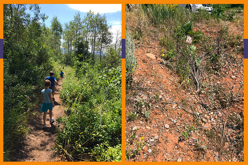
The trailhead at Big Mountain Summit
From the parking lot, you can easily access the Mormon Pioneer Trail going down the west side of Big Mountain (ie, heading toward Salt Lake). Continue on it for 3 miles, and you’d end up at Little Dell Reservoir. My kids weren’t up for that, and we didn’t have a way to get back to the minivan, so we hiked along the trail for a bit, then returned to the car.
The biggest little mountain on the trail
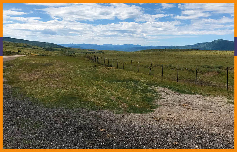
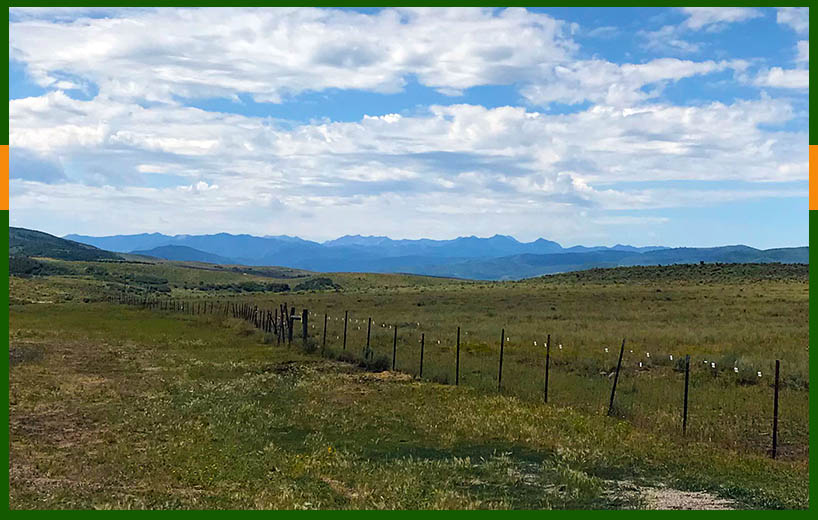
From Big Mountain Summit, the road winds down the mountain, crisscrossing the original trail. We passed by Little Dell Reservoir, which also submerges the original trail.
At the top of Little Mountain Summit, we pulled into the parking lot to get a view of the steep incline the pioneers had to scale. 2-3 teams of oxen were needed pull one wagon up the incline. A wagon was usually pulled by 6-8 oxen — so that would be 12 to 24 oxen pulling one wagon up the mountain!
Leaving Little Mountain Summit you drop into Emigration Canyon. Having never been in this canyon, I was somewhat (unpleasantly) surprised to see how populated it is. I had imagined it as uninhabited.
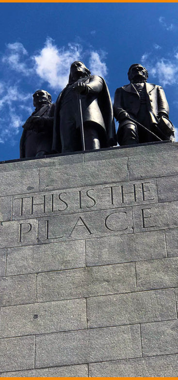
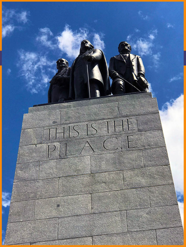
This Is the Place … where the journey ends
And then we came out of Emigration Canyon into the Salt Lake Valley! We made it.
We stopped at This Is the Place Monument, which is at the canyon’s mouth. This is near where Brigham Young supposedly said, “This is the right place, drive on.”
It’s a nice ending point to the journey, plus there’s a big field where kids can let that energy out.
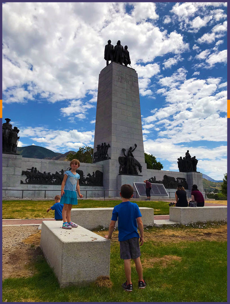
This Is the Place Heritage Park is next to the monument. Visitors can tour a pioneer village and participate in other pioneer-ish experiences. (There is a fee for entry to the park; visiting the monument is free.)
Did I really lie to my kids?
“This is the first day I’ve learned about my ancestors!” my 6-year-old daughter exclaimed as we left This Is the Place Monument.
Oh, that’s music to this family-history-loving mama!
“You lied to us,” my 7-year-old son pronounced at one point. “You said this was going to be fun, but it isn’t.”
Despite this, he seemed to catch the spirit of what we were doing. He imagined what it would have been like to be a child walking through the canyons and up the mountains. He couldn’t understand why people weren’t allowed to ride in the covered wagons.
I think something struck each of them. And I’m so glad we did this road trip.
A little living history never hurt anyone. And perhaps they got a glimpse of how good their life really is.
Want to do this? I made you (free) turn-by-turn directions
Want to take your own pioneer trek — in an air conditioned car?
I’ve created a free printable guide for you! It includes turn-by-turn driving directions to all of these stops — including places where you can walk the original trail. (We’re talking easy strolls to hiking a mountain.)
All you have to do is download it and go!
This would be a great Pioneer Day road trip from Salt Lake City, especially if you have family who traveled the Mormon Pioneer Trail. (I don’t know how much traffic you’d find on a holiday weekend. We saw very few people on the mid-August Friday when we went.)
If I’d been more ambitious, I would have found and shared stories about our pioneer people who came across the trail.
Got an outdoorsy family? Hiking or biking one of the longer stretches of the trail might be a great way to combine a fun family activity with stories of your family who did the same thing — except just not for the fun of it.
Have you ever explored the Mormon Pioneer Trail in Utah or another state? What did you like best? What are your must-see suggestions? Let me know in the comments.
Know anyone who’d love this Utah day trip?
If you have family or friends who’d love to do this kid friendly day trip from Salt Lake City, please let them know about it by sharing on social or email. Thanks!
Read Next