American servicemen called it “The Rock.” An island fortress at the mouth of Manila Harbor, Corregidor guarded the entrance.
And if the Japanese wanted to take full control of Luzon (the Philippine island where Manila city resides) during World War 2, they HAD to take Corregidor.
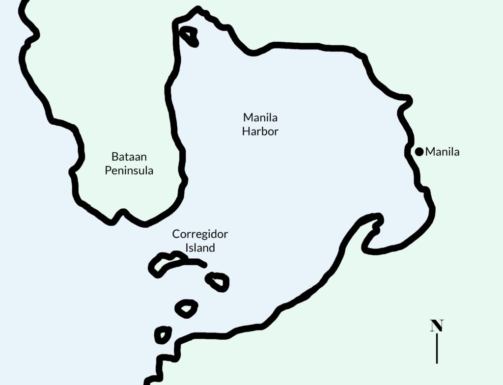
But the small island–just 4 miles long and roughly 1 mile wide (at its widest point)–wasn’t an easy conquest. Corregidor was home to Fort Mills, a heavily fortified military base. And, at the outbreak of WW2, it housed some 13,000 American and Filipino servicemen and women.
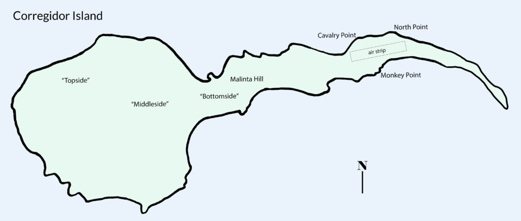
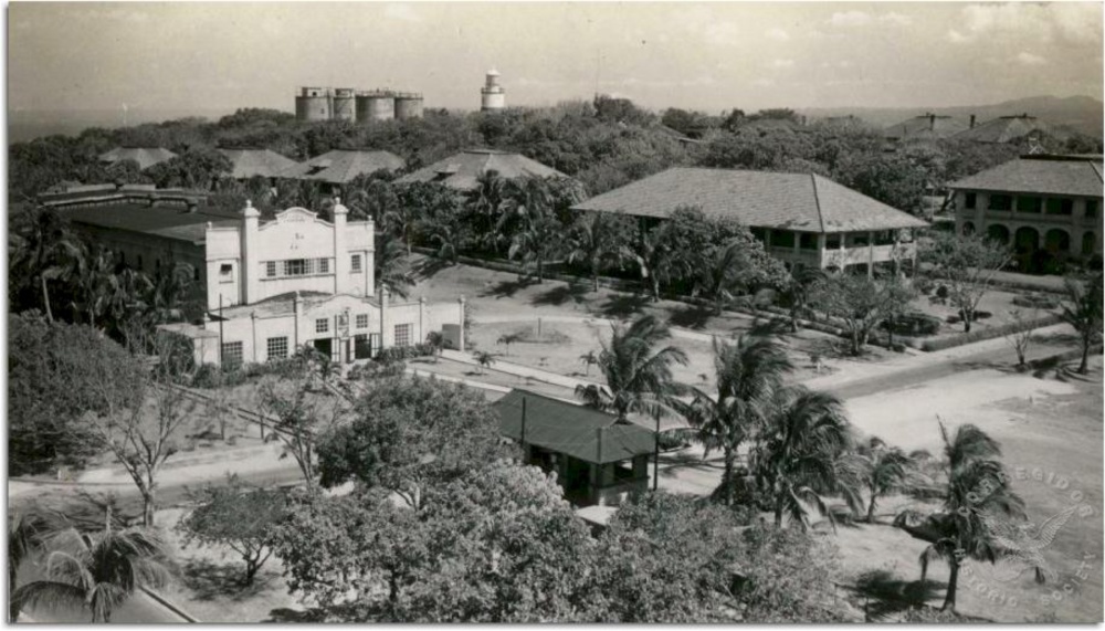
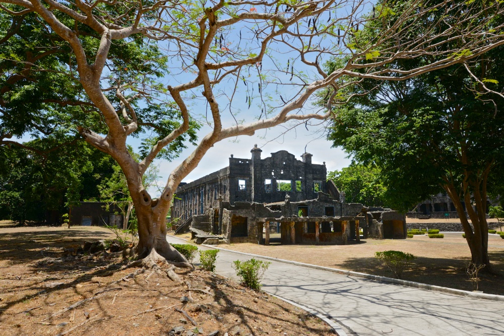
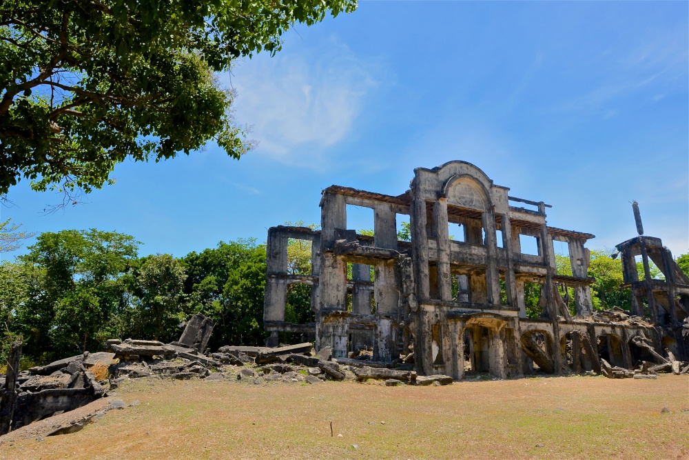
Topside’s above-ground military base
Corregidor’s “Topside” and “Middleside” areas included officers’ quarters and enlisted barracks, a movie theater, a couple of schools, numerous gun batteries, underground Army headquarters, a fortified communications center (also underground), and a golf course…for the officers.
Down to bottomside
The island dips down to “Bottomside,” where Navy and other ships docked on both the north and the south sides. The island slopes up again to Malinta Hill.
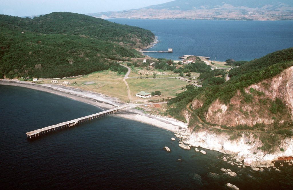
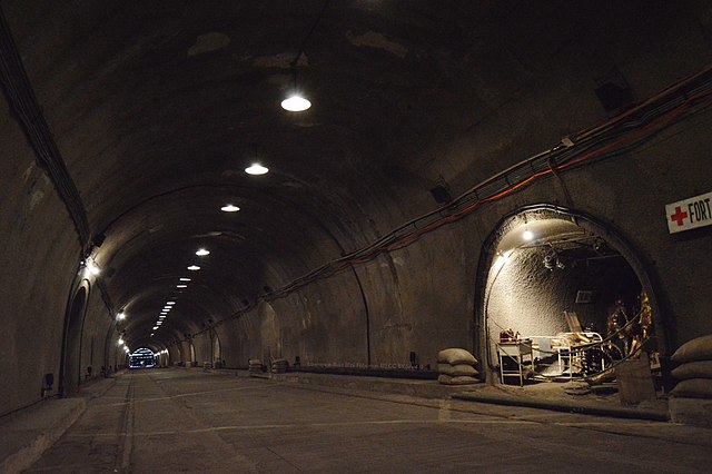
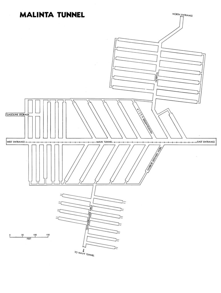
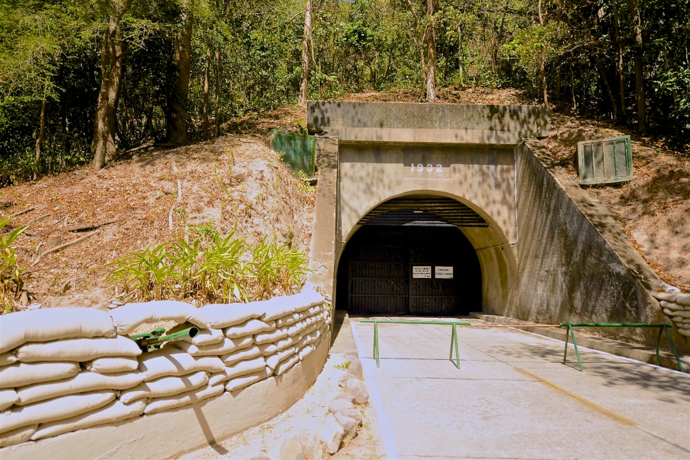
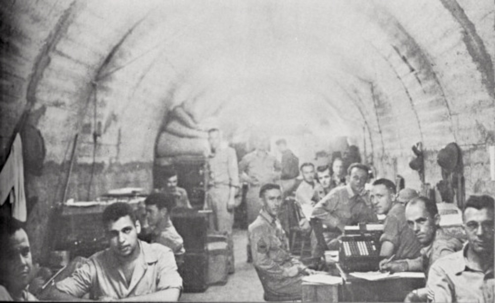
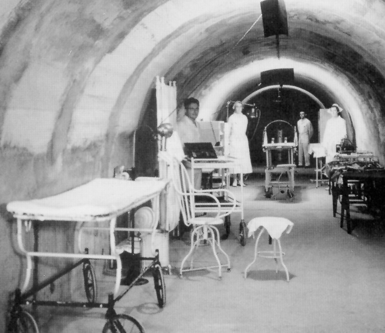
Malinta Hill’s tunnel-maze military base
Within Malinta Hill is the Malinta Tunnel–a labyrinth-like system of tunnels that cuts, east to west, through the hill. As Japanese bombing of Corregidor island increased in spring 1942, Fort Mills’ headquarters was moved from Topside in to Malinta Tunnel.
The Japanese invade
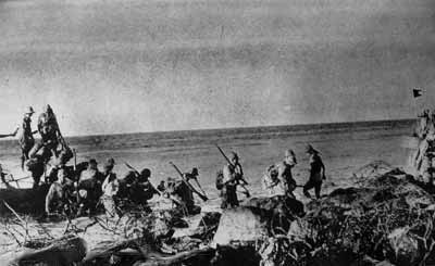
Japanese troops landed on Corregidor the night of May 5-6, 1942.
They had laid siege to the island for 4 months, increasing their bombardment in early April once they had taken the Bataan Peninsula. Taking Corregidor was key to the Japanese taking full control of The Philippines in WW2.
The American and Filipino defenders resisted well. Corregidor was well fortified with numerous batteries equipped with coastal guns, mortars, and anti-aircraft guns. But food and water for the island’s 13,000 personnel were running out. And few American relief ships were able to land.
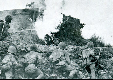
800 Japanese soldiers made up the first invasion landing, coming ashore between Cavalry Point and North Point (see map above). Rough seas, beaches slick with oil from bombed ships, and intense resistance from Americans and Filipinos, especially the 4th Marines Regiment, led to heavy casualties from the first Japanese troop landings.
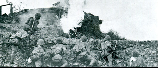
Lack of ammunition on both sides led to hand-to-hand fighting. But despite the Allies fierce resistance, the Japanese advanced–south to Monkey Point and west toward Malinta Tunnel.
The US surrenders
In early afternoon on May 6, 1942, Lt. Gen. Jonathan Wainwright sent out the surrender message. He knew the Allies could not hold the island much longer and hoped to spare as many lives as possible. “There is a limit of human endurance,” he radioed to President Franklin D. Roosevelt, “and that point has long been passed.”
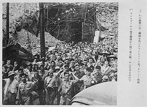
At day’s end, 800 Allies had been killed and 1,000 wounded. Alma Salm and some 11,000 other Americans and Filipinos were taken as POWs.
Sadly, these individuals’ test of endurance was just beginning. They would be sent to various prisoner of war camps throughout The Philippines and Asia. Some would spend the next three years in brutal captivity before being liberated. Many, however, would never see freedom again.
What do you think?
I’ve honestly been astounded by the photos I’ve been able to find about the Corregidor military base and invasion. It’s just amazing to me how much WW2 was photographed. And how real these photos make the places and events that Alma Salm described in his memoir.
I’d love to know what you think of these photos. Are you geeking out over them as much as I am? Write a comment below and let me know!
Read Next

Know anyone who would appreciate this post?
If you know anyone who would be in to this photo journal of the Corregidor invasion, please consider sending them the link to this page or sharing it on social media. Thank you!
Sources
- “Battle of Corregidor,” Wikipedia, found online at https://en.wikipedia.org/wiki/Battle_of_Corregidor, accessed 2 June 2019.
- “Corregidor,” Wikipedia, found online at https://en.wikipedia.org/wiki/Corregidor, accessed 1 June 2019.
- “Fort Mills,” Wikipedia, found online at https://en.wikipedia.org/wiki/Fort_Mills, accessed 1 June 2019.
- “Malinta Tunnel,” Wikipedia, found online at https://en.wikipedia.org/wiki/Malinta_Tunnel, accessed 1 June 2019.
- Morton, Louis, “Japanese Plans and American Defenses,” in The War in the Pacific: The Fall of the Philippines (Washington, DC: Center for Military History, 1953), found online at https://history.army.mil/books/wwii/5-2/5-2_29.htm, accessed 2 June 1942.
Images
- Images 1 and 3: Maps created by Anastasia Harman, 2019.
- Image 2: Aerial view of Corregidor. Taken by Storm Crypt, October 2005, found online at https://www.flickr.com/photos/storm-crypt/459962586/in/photostream/, accessed 20 May 2019.
- Image 4: Fort Mills, ca 1941. Courtesy Corregidor Historic Foundation, public domain. Found online at https://www.dvidshub.net/image/3587745/corregidor-fort-mills. Accessed 2 June 2019.
- Image 5: Corregidor theater ruins. US Coast Guard Photo, taken by CPO Sarah Muir, public domain, Photo ID: 3587871, VIRIN: 170510-G-IA651-1006, found online at https://www.dvidshub.net/image/3587871/cine-corregidor, accessed 2 June 2019.
- Image 6: Barracks ruins. US Coast Guard Photo, taken by CPO Sarah Muir, public domain, Photo ID: 3587765, VIRIN: 170510-G-IA651-1003, found online at https://www.dvidshub.net/image/3587765/corregidor-barracks, accessed 2 June 2019.
- Image 7: Aerial view of Bottomside. US Army photo, public domain, found online at https://en.wikipedia.org/wiki/Corregidor#/media/File:Rock_Middleside.jpg, accessed 2 June 2019.
- Image 8: Interior of Malinta Tunnel. Photographed by Lawrence Ruiz, March 2019. Original image. Found online at Wikipedia Creative Commons, https://en.wikipedia.org/wiki/Malinta_Tunnel#/media/File:Malinta_Tunnel_2019.jpg, accessed 2 June 2019.
- Image 9: Malinta Tunnel diagram, US Army creation, public domain, found online at https://commons.wikimedia.org/wiki/File:Malinta_tunnel_diagram.jpg, access 1 June 2019.
- Image 10: Eastern entrance to Malinta Tunnel. US Coast Guard Photo, taken by CPO Sarah Muir, public domain, Photo ID: 3588089, VIRIN: 170510-G-IA651-1012, found online at https://www.dvidshub.net/image/3588089/malinta-tunnel, accessed 2 June 2019.
- Image 11: US troops in Malinta tunnel. US Army photograph, public domain, Photo ID: 3587779, VIRIN: 410000-G-GO214-1005, found online at https://www.dvidshub.net/image/3587779/troops-malinta-tunnel, accessed 19 May 2019.
- Image 12: Malinta Tunnel hospital wing, US Army Signal Corps, public domain, found online at https://en.wikipedia.org/wiki/Angels_of_Bataan#/media/File:Malinta_Tunnel_Hospital.jpg, accessed 1 June 2019.
- Image 13: Japanese landing on Corregidor. Public domain, found online at https://commons.wikimedia.org/wiki/File:Correg-japanese-landing.jpg, accessed 2 June 2019.
- Image 14: Japanese flame thrower on Corregidor. National Archives and Records Administration image. Found online at https://www.army.mil/article/179370/after_pearl_harbor_soldiers_held_out_for_months_against_japanese_invasion_of_philippines, accessed 2 June 2019.
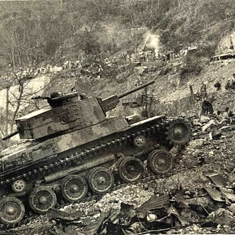
- Image 15: Japanese tank on Corregidor. Post by ChadHill, 13 October 2012, Japanese Tanks message board, Corregidor Then and Now, found online at http://corregidor.proboards.com/thread/429/japanese-tanks, accessed 2 June 2019.
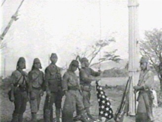
- Image 16: Japanese stage removing American flag on Corregidor, found online at “World War II, 1942-43,” History Hub, https://sites.austincc.edu/caddis/world-war-ii-1942-43/, accessed 20 May 2019.
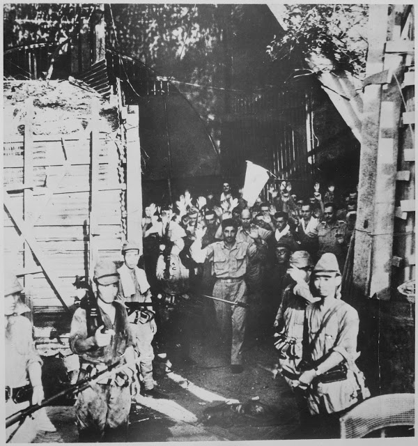
- Image 17: Staged surrender of Americans on Corregidor. NARA (National Archives) Record Group 208: Records of the Office of War Information, 1926 – 1951 (ARC identifier: 535). Series: Photographs of the Allies and Axis, compiled 1942 – 1945 (ARC identifier: 535523). NAIL Control Number: NWDNS-208-AA-80B-1. Select List Identifier: WWII #129 http://commons.wikimedia.org/wiki/File:Surrender_of_American_troops_at_Corregidor,_Philippine_Islands,_05-1942_-_NARA_-_535553.jpg
- Image 18: Americans surrender, with Japanese writing on side. National Archives and Records Administration image, found online at https://www.army.mil/article/179370/after_pearl_harbor_soldiers_held_out_for_months_against_japanese_invasion_of_philippines.

These are remarkable images and stories. It is so fascinating to read about and understand through pictures what these valiant soldiers went through in defense of this country and our freedoms.
Yes, it’s so true. And we live in a time when so much is now available online. When Alma wrote his memoir, he didn’t have access to any of these images to show to his family. He probably couldn’t have guessed some of these photos even existed!